Today marks the completion of a seven day Facebook Photo Challenge I accepted after nomination by a ‘mate.’
One of the terms of acceptance was to nominate two others to take up the ‘challenge.’
One of the individuals who accepted my nomination indicated that he had no intention of nominating anyone else to enter and gave the reasons for his decision.
During the past seven days I’ve thought a lot about these so called Facebook photography challenges.
When I first opened a Facebook account I readily accepted these challenge nominations and found them to be fun.
After a while though the ‘fun’ factor reduced to almost zero and I accepted nominations purely on the basis of not wanting to disappoint the nominators.
Then, as happened to my nominee mentioned above, my nominations seemed to get lost somewhere in the blogasphere.
Now, on reflection, I’ve come to the conclusion that what once was fun has become an unwelcome time waster.
Accordingly, from this day on, this little black duck will gracefully decline to accept any Facebook photo challenge nominations.
It’s hypocritical of course but what pops up here in blog world is vastly different and I view what happens in this space with a totally different mind set.
Wouldn’t you think that I have been around long enough to resist nomination for Facebook competitions. Once bitten twice shy as the saying goes.
I thought so too but in a moment of weakness I accepted a mate’s nomination and signed on for an image a day for seven days. As you are probably aware, acceptance includes an expectation that others will be nominated too. Accordingly I nominated two others to take up the challenge, both of whom accepted.
This time around I’ve opted to cheat, just a little bit. After all an image is an image no matter it’s age and provided it fits the required genre.
I searched my records and came up with four suitable archived images and since my nomination have photographed the other three.
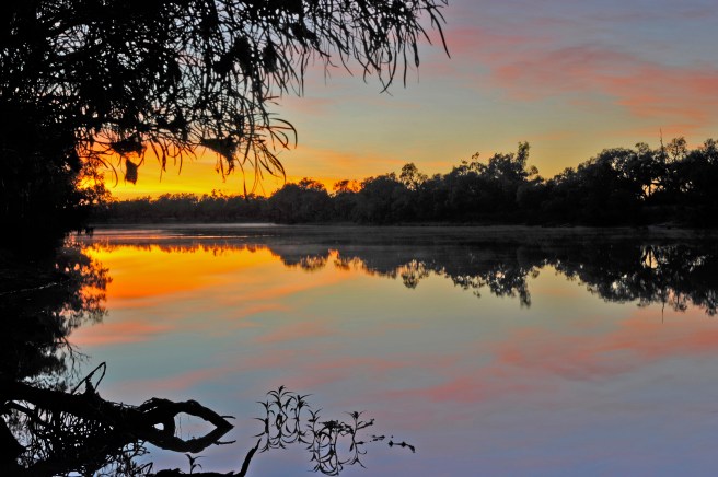
Last Tuesday was Day 1 and I uploaded an image I’d taken at dawn that morning from our front verandah. Here it is:
On Wednesday morning I cheated and uploaded this image from my archives:
Then this morning I was at it again with one from the archives, showing a section of Mt Riddock Cattle Station in what is known as the bottom end of the Northern Territory. It’s from a scan of a Kodak ISO 25 slide:
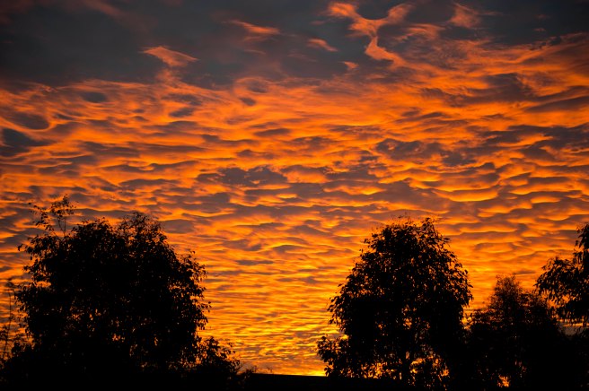
I’m undecided with the order in which I’ll post the remaining four images, two of which are archival and two taken since last Tuesday. The first of the four is of a sunset I shot just after 5pm on the 20th May, 2011 from our back door.
For the technical minded I used my Nikon D700 with my Nikkor 70-200 mm f2.8 lens set at 70mm, 1/125th second at f2.8, ISO 200:
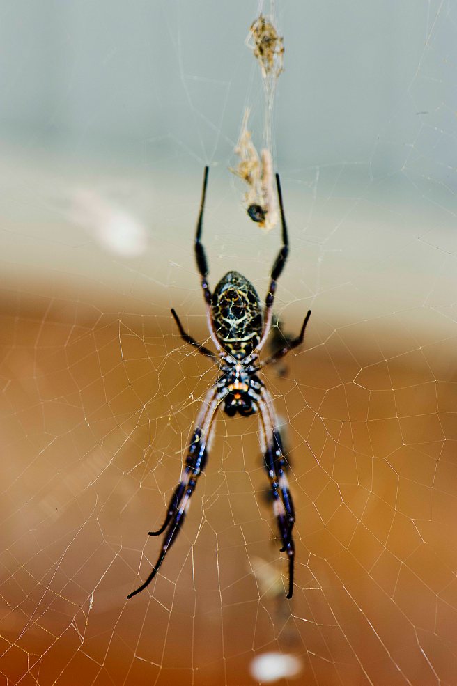
This next image is also archival from last summer. I used my D700 and Nikkor 105mm f2.8 Macro lens set at 1/80th second, f9, ISO 200 with the Nikon Speedlight SB 800 to bring our more detail:
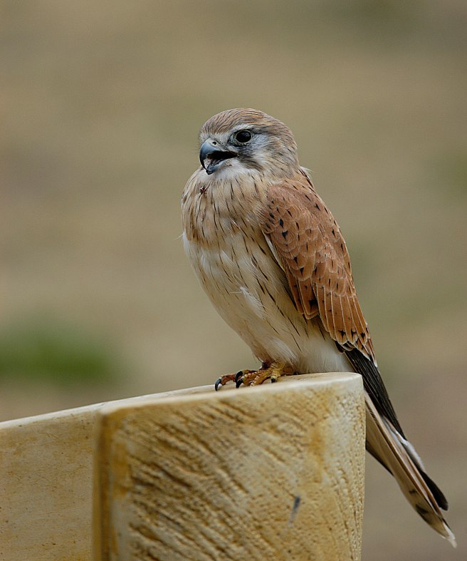
The last two images were made yesterday during a break in the lousy light conditions when the two Galahs and the Nankeen Kestrel made their entrance into our backyard, not at the same time of course.
Both images were made using my D810 with the Nikkor 300mm lens , aperture priority f4, 1.1250th second at ISO 100.
Will I take up another nomination in some future competition? Taking a leaf out of every politicians note book, I’ll never say never, just in case.
During the adventure I’ve detailed in the previous nine posts, I didn’t worry too much about keeping copious notes. However, I did tick off the days as they passed by.
As it transpired, purely by luck and not good management, the 19th July, 1973 became the most significant day during the whole of the journey.
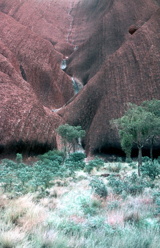
That was the day I photographed Ayres Rock, Uluru to give it the correct title, with water cascading down its sides. Yes indeed, it was raining on The Rock.
Now many people, myself included, were of the belief that The Rock was discovered in 1872 by Ernest Giles. It’s true that Giles was the first white man to see the monolith from a distance and he returned to claim it in 1873.
However, he was beaten to it by William Goss who, on the 19th July, 1873 at The Rock, claimed and named it Ayres Rock after the Chief Secretary of South Australia, Sir Henry Ayres.
According to many references, it was raining on The Rock on the 19th July, 1873, exactly 100 years to the day that John G and I witnessed the same scene as had William Goss.
Here is that great image, once again.
RAINING ON ULURU, 19th JULY 1973.
I’ve also mentioned Walter Smith on many occasions and I kept in touch with him for 17 years until his death in June 1990, just days before his 97th birthday.
My thoughts of Walter were revived recently at the funeral of another mate whose legendary exploits were canvassed by various speakers at the funeral.
Later at the wake it was pointed out that legends only live when they are repeated and that was certainly the case with Walter. Once you got to know him he reinforced his legend that he was part Afghan and part Aranda.
On a number of occasions he told me that his tribal name was Wati Yuritja which meant Man of the Water Dreaming. He reiterated on a number of occasions his association with the explorer Madigan and the discovery of the monster meteorite samples and detailed his exploits as a cameleer.
I admired Walter and his bush craft and I regularly repeated his legend to anyone who would listen.
In 1998 on visit to Uluru-Kata Tjuta I found a biography of Walter Smith and bought it on the spot, mainly out of curiosity.
The book has sat comfortably on a bookshelf here in my office, almost forgotten until this morning and flicking through it I’ve discovered a number of details concerning Walter’s legend, all of which are referenced and accurate..
Firstly, Walter Smith was neither part Afghan nor Aboriginal by birth. Walter was born on the 2nd July, 1893 at Arltunga not far from Harts Range in the Northern Territory.
His father, William Smith, a Welsh miner and his wife Topsy had, over the next twenty one years, ten more children after the birth Walter.
According to the biography, all of Walter’s camel exploits are true and he was certainly a renown bushman during his life.
The most extraordinary fact I’ve now discovered that it was not Madigan with whom Walter associated but the famous ill fated explorer L.H. Lasseter of lost gold mine fame.
Walter provided the camels and accompanied Lasseter for much of his journey to find the lost mine, a journey that cost Lasseter his life.
Also, it was Walter who discovered the massive meteorite at Henbury and dispatched it to a South Australian museum for assessment.
Digging out Kimber’s book has reignited my interest in Walter Smith and he is now my subject of much future research.
Finally, I thought I’d make some concluding comments about the so called Simpson Desert expedition.
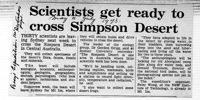
My long departed mother was my active social secretary and whenever she came across something even remotely associated with my activities it was collected and stored it away. Here is a classic example of Mum’s collecting.
A NEWSPAPER CUTTING
Some months after the main mob returned to Sydney, the Australian Museum in Sydney hosted a get together for all the participants. The few of us who attended were given the opportunity to see many of the bird samples collected by the ornithologists, together with a range of amphibians, a reptile or two but absolutely zero from the world of geology.
If my memory serves me correctly, I was the only representative of the small Land Rover Club group and geologist John G was also absent.
Those of us who volunteered with our four wheel drives were assured our costs would be met. Only forty three years have passed and I’m still checking the mail.
I visited the NSW Institute of Technology, Geology Department to see John G some time after my return. I saw the mounted feldspar crystal taj=king pride of place in the foyer of the department. No sign of John G so I left a message for him to telephone me. As the crow flies, my office was not far from his. A phone call never came and I never laid eyes on him again.
Linz the prospector, Dr Dave and I remain in regular contact. Over the next few years I was such a regular visitor to the Harts Range Police Station and a regular driver of the Station’s vehicle that Eddy insisted I apply for a Northern Territory Drivers Licence. I did so and held it for about ten years before surrendering it.
Eddy eventually transferred to Darwin, suffered terrible losses in Cyclone Tracy and we accommodated him at home in Sydney when he was given leave to come south and recuperate. On his return to Darwin I visited him on a number of occasions but he retired and I’ve have lost all contact with him.
Well there we are. As is the rule, what goes on tour stays on tour, so that’s it folks.
The home fires were burning brightly when we started the run to Adelaide to suit John’s arrangements. Unfortunately the sky was not as bright and rain was still obviously to be expected.
We turned right from the Lasseter Highway onto the Stuart Highway south of Alice Springs and as we neared Marla John suggested we detour via Oodnadatta and through to Leigh Creek where he hoped to collect some Tektite.
He explained that Tektite, a pure glass, could be coloured black, brown or green. It was a terrestrial debris he explained, ejected during extraterrestrial meteorite impacts.
I was intrigued and John added that the area around Leigh Creek had the largest Tektite fields in Australia. I wasn’t sure if John’s suggestion was designed to placate me but if it was, he certainly succeeded. I was now hooked on Tektite.
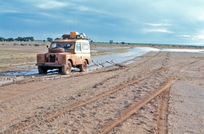
The moment we turned off at Marla the driving fun began and the 211 klms to Oodnadatta was a great mud run.
A TYPICAL PART OF THE MUD RUN BETWEEN MARLA AND OODNADATTA.
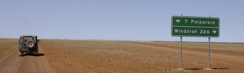
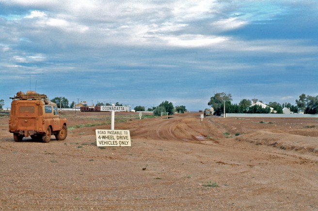
When we finally reached Oodnadatta, the sign at the town’s entry told it all and what we could expect next.
MY MUDDY LANDY AT THE ENTRY TO OODNADATTA.
We stopped for coffee and snacks in town and having a yarn with curious locals revealed the fun we were going to have on the next section through to Maree.
The going was quite slow and we decided to make an early camp if we could find a dry spot.
Luckily enough we came upon a nice spot complete with a tree and some great examples of Sturt’s Desert Pea which thrives in arid conditions.
OUR DRY OVERNIGHT CAMP SITE COMPLETE WITH BLUE SKIES.
Sturt’s Desert Pea is a beautiful desert plant with its vibrant colour and interesting foliage.
STURT’S DESERT PEA.A CLOSE UP. GREAT FORM AND COLOUR.
Next morning we made another early start. I can’t speak for my passenger John, but as the driver it was a heap of fun. If I recall correctly, the next day the road from Oodnadatta to Maree was closed to all traffic and this sign was an indication of why that took place.
THE SIGNS TELL IT ALL.
The track we were on runs parallel with the old Ghan Railway line which in those days terminated at Alice Springs. The Ghan was named after the Afghan camel drivers who back in the 1890’s and early 1900’s were the major source of goods transport between Port Augusta in South Australia and the Northern Territory.
Trains running along the line where often held up by sand drifts and floods and could be sometimes be delayed for days as the train crew shovelled the stand off the lines or waited for flood waters to recede.
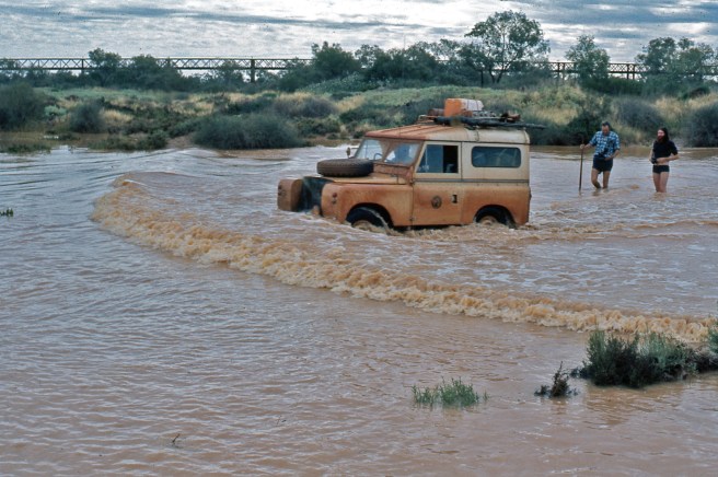
As we travelled further south we made quite a few little creek crossings and all seemed Ok until we reached the Algiebuckiner River which was in flood. There was Nissan Patrol 4 x 4 stopped on our side of the river and a what looked like a Toyota Landcruiser stopped on the other side.
I knew that knee high water that wasn’t flowing too swiftly was fordable in my little Landy, provided that the crossing’s bed wasn’t too soft.
I waded across to the other side and the water only reached my knees. Fortunately the river bed seemed more gravelly than mud or sand and the river flow was almost at a standstill. After checking from side to side of the path I’d checked I decided that a crossing would be manageable and waded back to John and the Landy.
The photo opportunity was too good to miss so I armed John with my camera and he waded across to a view point I had indicated to him and adopted his temporary role as trip photographer.
All of this mucking about had a positive side to it as the Landy’s engine, gear box and differentials had cooled down somewhat, therefore reducing the risk of their breathers sucking water in the event of a disaster during the crossing.
All that was left for me to do was to fit my small tarpaulin radiator cover and drive across to the other side, sticking to the path I’d chosen.
I decided on low range third gear to maintain a reasonable speed to produce a great bow wave and felt confident that all would be well. On many trips with the Land Rover Club, river crossings were encountered and I’d had quite a bit of experience in water crossings. I remembered to maintain a steady accelerator pressure and keep my left foot away from the clutch pedal.
Engine switched on, third gear engaged and off we went, riding well behind a great bow wave.
We reached the other side without a problem, not a drop of water entered the cabin and the little engine didn’t miss a beat. Modern 4 x 4 owners please note, not a snorkel tube in sight.
When the slides were finally processed, John’s photographic skills were evident as the following images show.
QUITE A WIDE EXPANSE TO BE FORDED.
THE WADING COMMENCES.
NO PEDESTRIAN CROSSING HERE – GET OUT OF THE WAY DUMMIES.NEARLY THERE, NOT A PROBLEM. NOTHING LIKE A LANDCOVER.
In this last image, you can see the old railway bridge over the river and the length of the bridge is a clear indication of how wide the river can become when in full flood.
Finally we reached Maree, fuelled up again and shortly afterwards arrived in Leigh Creek where we camped overnight, ready for an early start searching for Tektites.
Our search was fruitful too with John collecting many, many samples and I limited myself to about half a dozen or so.
I’ve searched high and low for my Tektite samples but they have simply disappeared during the ensuing years and my multiple address changes.
We continued on and stopped overnight just outside Quorn ready for the run into Adelaide the next day.
John and I said our farewells in Adelaide, South Australia and I started off towards home in Cronulla, New South Wales.
Strangely my thoughts on the way home were more about my return to work and what had happened there during my long absence.
I was soon to find out.
Thanks for reading, it’s been a lot of fun putting this series together and the process has brought back many,many great memories.
John and I got an early start en route to The Olgas or Kata Tjuta as we should call them. Even though the sky was overcast again it didn’t dampen out enthusiasm for what lay ahead.
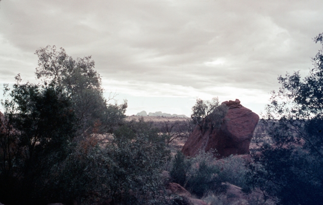
From quite a distance over the last few days we had glimpsed the Olgas on a number of occasions. Here is one such glimpse taken from foot The Rock itself.
A DISTANT KATA TJUKA
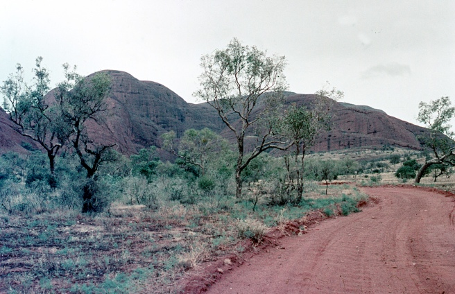
However, getting closer revealed how mysterious and dominating they really are.
ON THE APPROACH TO KUTA TJUKA FROM ULURU.GETTING CLOSER.JUST AROUND THE NEXT BEND -PERHAPS.
Then suddenly Mt Olga loomed large and dominating the landscape.
Mt OLGA
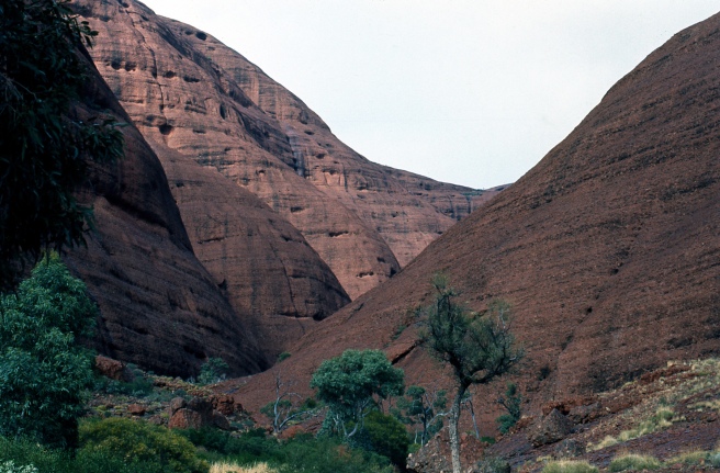
As you get closer, the impact of The Olgas increases and I couldn’t help but wonder about the Initiation Ceremonies that traditionally took place there. In fact, on a subsequent visit a year or so later I learned that Secret Men’s Business, at significant times, still takes place there.
CLOSER STILL TO Mt OLGA.
John G continued to demonstrate his navigational skills and not long after this shot was taken, guess what.
WRONG WAY CHARLIE BROWN
To be fair, back then there was no such thing as civilian GPS. Map and compass was the way it was done. Our topographical map was getting a bit battered and we had been lucky that on only a few occasions a U turn was required. This was one such time. Strangely, John appeared reluctant to use my souvenired military issue magnetic compass.
‘NEVER REALLY LOST’ TO QUOTE FROM PADDY PALLING FAMOUS BUSHWALKING BOOK.
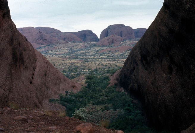
Eventually we reached the spot we were looking for in order that we could walk into The Valley of the Winds. In 1973 it was quite a different climb to the way it is today. The track was feint and mostly very hard to find and the going was very rough and in spots particularly steep. Finally we reached the spot near where the Valley began.
NEAR THE ENTRANCE TO THE APTLY NAMED VALLEY OF THE WINDS.
The view into the Valley proper was breathtaking and my image just doesn’t do it justice.
THE VALLEY OF THE WINDS.
On a number of subsequent trips I’ve been fortunate to descend to the valley floor and explore its fascinating features. It’s an immense area and never fails to amaze everyone who visits there.
Unfortunately, both John and I were now both facing time restraints and decided to begin our journey home.
We journeyed back to The Rock, replenished our depleted water supply and started back to civilisation.
Here is our last sighting of Ayres Rock.
On reflection, John and I had been in close company for many weeks. Mostly with no other company close by. For two men who had just met we got on particularly well but I suspected as we left Ayres Rock that we were not really overjoyed with each others company any more.
Nothing had been said, there was no apparent tension and we were as courteous to each other as we had been since Day 1. However, to quote from the movie’ The Castle,’ ‘It’s The Vibes.’
That night as we sat around the camp fire our discussions turned to the return journey.
I’d planned to get home via Mt Isa and the route taken by the little group from the Land Rover Club. I indicated to John that would be quickest.
It was then that John informed me that it had been his intention all along to return to Sydney by air from Adelaide and he expected me to deliver him to the South Australian Capital. I gathered that he had an open ticket for that journey.
I must have been a softie way back then because I couldn’t bring myself to tell him what I thought. Instead I pointed out that the way south to Adelaide was mainly on dirt roads with some river crossings and that the rain we had experienced might provide some obstacles.
I gave a drop off for him in Alice Springs as an alternative but from his response I got the distinct impression that dollars and cents were an issue. I didn’t pursue it. After all, I hadn’t chased recompense for the gallons and gallons of petrol I’d brought. Anyway, what’s a bit of mud and water across the track for a short wheel base Landrover.
Two things must be said about camping in Australia’s outback and in my view are perhaps the most significant elements of the experience.
The first is the sky. Day and night you have a three hundred and sixty degree unimpeded view. It’s like living inside a gigantic inverted pudding bowl. There are just not enough adjectives to fully describe the feeling the sky and its stars create.
The second is the absolute silence. Except for the occasional breeze through the trees, the rustle of the grass and the sounds of native animals going about their night time routines. Many describe it as ‘The Sound of Silence.’ Hows right they are.
John and I awoke to a clear day, with not a drop of rain and great light for photography and so we decided to circumnavigate The Rock on foot for the second time.
Way back then there were no access impediments and everything was accessible.
Uluru, to give it its Aboriginal name is revered by Aboriginal people and is a genuine Special Place or Sacred Site as many now call such places.
To climb to the The Rock’s summit or anywhere on it, as many tourists are wont to do is considered sacrilege by Aboriginal people and now even the National Parks people advise against the climb but it is still not prohibited.
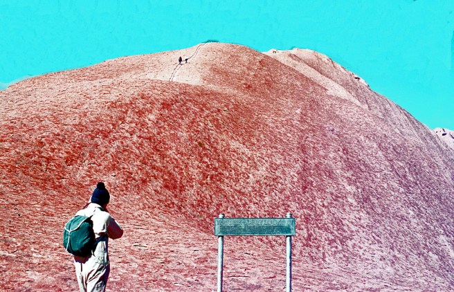
John was determined to do the climb and even although I politely requested that he observe Sacred Site status he did set off determined to make it to the summit.
I suggested to John that he take my camera with him and grab some images and he agreed.
JOHN G CONTEMPLATING THE CLIMB AHEAD.
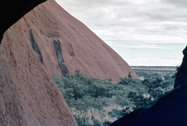
As I watched from the base, John got as far as the first pale spot just below the two individuals you can see and stopped. After a short break he turned around and descended. He never indicated why he had a change of heart. Giving me back the camera he said he had taken just one shot. Here it is.
A VIEW FROM ULURU TAKEN BY JOHN G.
After a brief interlude, we set off around The Rock for a second time, a distance of 9.4 klms or 5.8 miles. The Rock itself is sandstone, 348 metres or 1,142 feet high. It’s 863 metres or 2,831 feet above sea level.
The Anangu people who are the traditional owners of Uluru have a name for every individual element of Uluru’s rock faces. Way back then I’d learned many of the namers and committed them to memory but now, all of those years later I can recall only a few and that’s why I’ve refrained from giving a specific name to any of the following images made on our seemingly endless walk. I made many more images during this walk but they are now missing from my archive.
THIS ONE IS OBVIOUS THOUGH, ‘KANGAROO TAIL’.
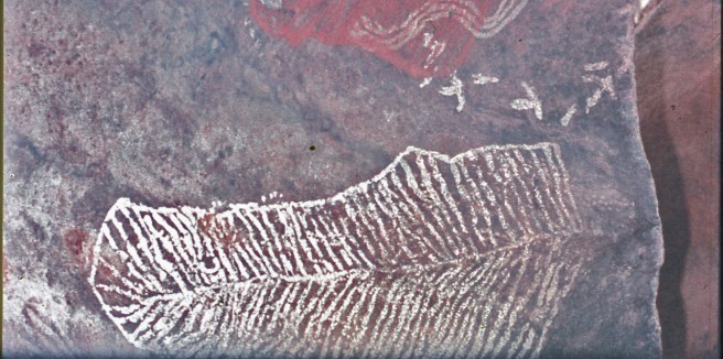
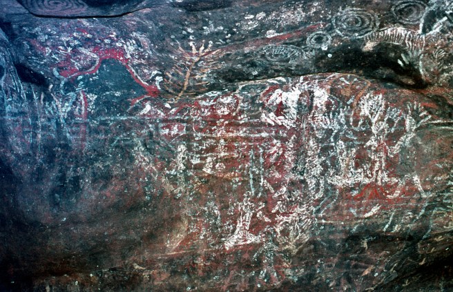
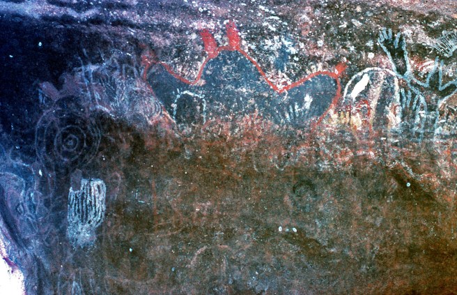
Ancient and more recent rock art by the Anangu people is in abundance at Uluru and I was fortunate to photograph some of them. I’d neglected to bring a flash unit for my camera and in many of the painting locations the light and the slowness of my slide film, 25 ASA prevented me from taking any useable photographs.
On this walk I found this blaze on one of the small trees. My inquiries with some of the locals who spoke English provided no information as to the source or meaning of the blaze. Subsequent inquiries have also drawn a blank and I’ve never stopped wondering about its origins.
Our walk complete, we wandered back to the Landy and hunted up camp site for the night. Finally we decided on a spot in the main observation area where one camp had already been set up.
THE MAIN VIEWING AREA IN 1973. ALMOST PACKED OUT.
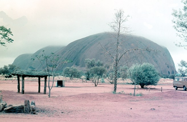
We selected a site far from the maddening crowd and close to the enormous amenities block you can see in the following image..
ABOUT AN HOUR OR SO AFTER THE PREVIOUS IMAGE. NOTE THE AMENITIES BLOCK IN THE RIGHT MIDDLE DISTANCE.
This is the view of Uluru that is most popular with tourists. As the evening sun drops lower in the sky, the colours of The Rock change dramatically. These days the observation area is much further back and well regulated. Of course the tiny amenities block is long gone and modern facilities are available close by as part of a large tourist facility.
Our forward planning included The Olgas, or Kata Tjuta to give it its correct Anangu name. The area is now officially the Uluru-Kata Tjuka National Park and is administered well by the traditional owners.
Accordingly, we prepared for the morrow’s early start and we will come to that in Part 8 so hoo roo till then.
In drizzling rain we left Henbury en route to Ayres Rock and The Olgas. I know I should call the The Rock correctly as Uluru but old habits die hard. After all, I first visited Ayres Rock in 1962 in my little Simca Aronde. I’ve no trace of the photos I took way back then but I remember that it was even less developed way back then.
We were disappointed that our Henbury meteorite hunt had been aborted but on the positive side we got out of Crater 6 without too much trouble and with no losses.
The closer we got to The Rock the more it rained and the soggier became the track. Fortunately I’d put new off road tyres on the Landy before leaving home and they were handling the wet conditions without fuss.
It’s the fortunate few who are able to see the impact of rain on the arid parts of the Territory and on this part of our adventure we were indeed fortunate as we passed this expanse of water on our way out from Henbury.
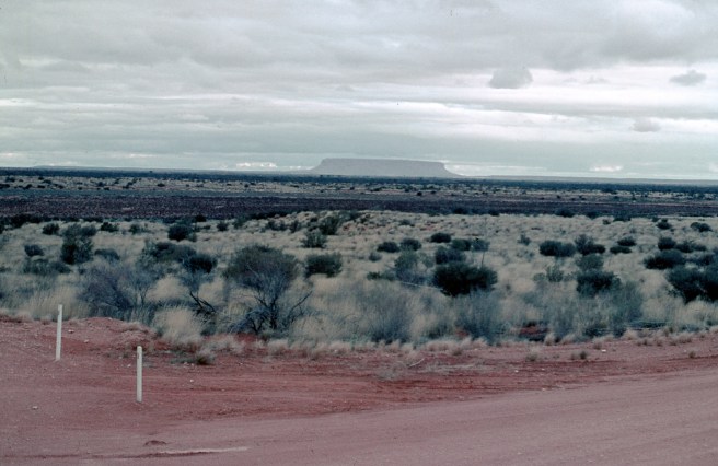
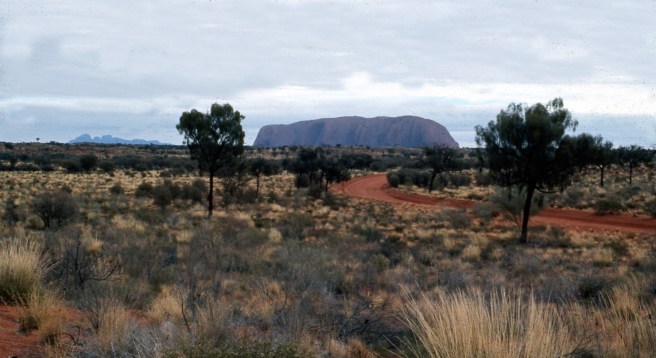
Not long after, in the distance we caught our first view of Mt Conner. This massive mesa is often mistaken by first time visitors as The Rock itself . There are a number of tracks that take you across to Mt Conner but as our time was running short we had to resist the urge to explore the mesa up close.
A DISTANT MtCONNOR FROM A DRY BIT OF ROAD.
Similarly to The Rock the changing light causes colours of Mt Conner to alter. Here is another view as we got closer and the light was changing.
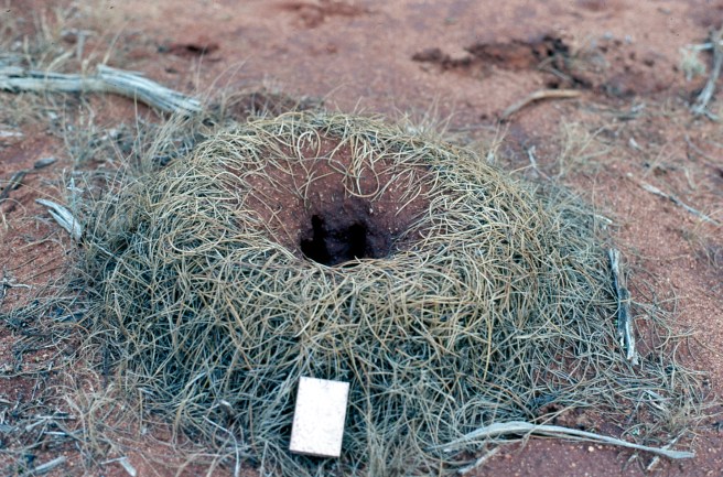
Where we stopped to make this last image of Mt Conner I noticed a Bull Ant’s nest with it’s built up water proofing mound. The old bushies and the Aboriginal people can tell when big rain is coming when they see the Bull Ants creating their little walls. I put the match box along side the nest to give an indication height.
A FLOOD PROOFED BULL ANTS’ NEST
Finally Ayres Rock with a distant view of the Olgas came into view. For once I made a note of the odometer reading and when I checked when were actually there, it was just over 9 miles from The Rock when I made the photo.
Back then the road into The Rock was just dirt and fitted into the landscape with no significant impact. It was well compacted dirt too and a pleasure to drive on, just as it was when I visited in 1962 in my little Simca.
NINE MILES OUT FROM THE ROCK.
A few isolated puddles on the road were an indication of the amount of rain that preceded our arrival.
A FEW PUDDLES ALONG THE ROAD.
Getting closer, the enormous size of this spectacular monolith becomes more apparent.
COLOUR CHANGES ARE ALMOST CONSTANT.
Finally we reached a vast cleared area near The Rock which now was covered by either low cloud or mist. It was an amazing sight.
AYRES ROCK SHROUDED IN MIST.
Closer still the light had changed again and the mist was beginning to lift revealing some of The Rocks features.
LIGHT CHANGES AND LIFTING MIST.NOTE THE VISITORS’ FACILITIES INCLUDING THE OPEN FIRE PIT.
After boiling the billy we decided to take a drive around The Rock and look for a spot to set up camp. Were we in for some surprises as we came upon streams of water gushing down the sides of The Rock.
RAINING ON THE ROCK. WHAT A RARE SIGHT. ANOTHER RARITYJUST A LITTLE BIT CLOSER.
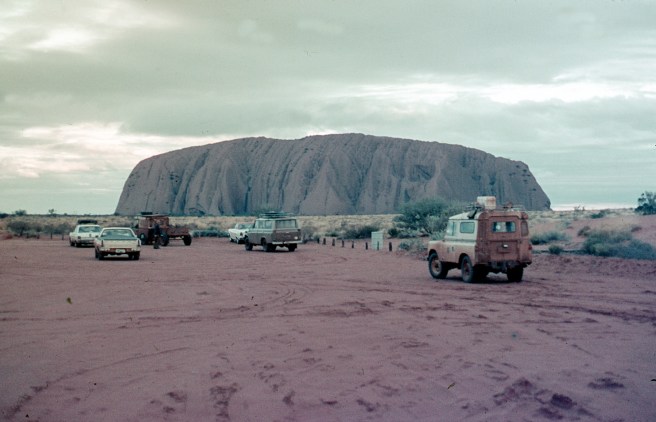
After circling the monolith we returned to the main observation car park and joined a crowd of five other vehicles with no people to be seen anywhere.
THE MAIN TOURIST OBSERVATION PLACE.
Later in the afternoon we moved around to a deserted spot and set up our camp early in order that we were organised to walk right around the Rock the next day.
Seeing the water cascading down the rock faces was an inspirational experience and I recognised the place as a genuine Sacred Site. I could feel the power and sense the mystery that was present.
In a strange way I was pleased that John never mentioned if he felt any personal impact from what we were observing.
Another plus was the total absence of any elements of bureaucracy, no commercial activity of note and all the visitors we encountered during our stay were responsible adults. How different it is there today.
After leaving Valley Bore at sunrise and dodging roos along the way, we arrived in good time in Alice Springs and went immediately to the railway station where we deposited the enormous box containing John’s mineral find.
It seemingly took forever for him to complete the paperwork necessary for the box and it’s contents too be delivered to the Sydney Technical College in Ultimo, a close city suburb where John taught.
After a hearty breakfast and filling the Landy’s two ten gallon fuel tanks and four jerry cans jerry with petrol, we set off for Henbury at top speed. By way of technical information, the 2.25 lire engine in my Landy could, downhill with a tail wind propel the vehicle up to about 50MPH. I think that’s about 80 KPH.
Eventually we reached the Henry Meteorite site after a few directional enquiries.
JOHN G IN NAVIGATOR MODE – IT’S THIS WAY, ISN’T IT?
There had been some rare downfalls of rain en route to Henbury but not enough to delay our arrival and not too long after midday we arrived at the meteorite site.
After checking his geological site map John suggested we camp in the Number 6 crater as around it’s rim we were most likely to find meteorite particles deposited there after the meteorite struck the ground and fragmenting as it created the crater.
MY LANDY PARKED IN THE No6 METEORITE CRATER AT HENBURY.
After setting up camp we scrambled up the crater wall and began our search for meteorite pieces using very sophisticated equipment John had brought all the way from his Sydney Office. After an extremely short hands on period of tuition, John declared me to be sufficiently trained to utilise the equipment. Fortunately he allowed me to keep my issued equipment in case I returned at a later date to continue the search.
I’ve retained it ever since and photographed it a few moments ago for your edification.
MY ISSUED SOPHISTICATED METEORITE DISCOVERY DEVICE..
Regretfully, the piece of string I used to drag the magnet along the rim of the crater has long since disintegrated and has simply disappeared.
Anyway, John and I dragged our string pulled magnets around the crater ring with great success. We both scored many, many small pieces of the highly magnetic meteorite but found no trace of the large piece Walter Smith had told us about.
Over the years I’ve given all but one piece of my Henbury meteorite to the student children of my friends and associates so they could skite at school and write projects about their little bit off space history.
Here is an image off my remaining sample that I took this morning.
HENBURY METEORITE.
The meteorite samples John and I recovered are all highly magnetic as shown in the following image, again made this morning.
QUITE A STRONG MAGNETIC BOND.
By the time John and I had circled the crater rime about twenty or more times it was time to relax and have a glass of wine or two.
While I played cook, John set about cataloguing his finds and writing up his day book. I learned a lot from John about documenting the day’s events. Yet, although at work I kept a daily diary of everything I did, down to the last detail, I made only scant notes on this whole expedition, except about what happened next.
Darkness descended rapidly and we retired to our tents for an early night.
About 6am the next morning I thought I was dreaming as my li-lo( air bed) seem to be moving about. I put my hand down and horror of horrors I was afloat in my tent.
I shot out of my sleeping bag to find that water inside the tent was over my ankles. I couldn’t believe it. Out of the tent like a rat out of trap, I saw that the crater was filling with water that was already almost up to the Landy’s wheel hubs where it was parked near by.
Almost simultaneously, John shot out of his tent and I told him I was going to try and get the Landy up the crater wall and down the other side before it became an impossible climb.
Luck was with me, I engaged low range second gear, and with minimum wheel spin drove directly up the crater wall, over the rim and down the other side onto soggy but well drained dirt.
I raced back up into the crater, pulled down the sodden tent, grabbed my gear and with tent dragging on the ground and air bed now deflated under my arm I struggled back up and over the crater, dumped my stuff on the ground and went back to help John. By that time the water seemed to have risen even more and it was lucky we noted our predicament when we did.
Strangely that morning, it seemed that John had enough gear with him to equip another full expedition. Never the less in a short time we had everything on the other side of the crater and nothing was missing.
It seemed to take forever to get all of our wet gear packed away and patchy rain had begun to fall intermitently.
We regretfully decided to abandon our meteorite searches and head off to Ayres Rock as it was then known and to the Olgas.
Before we headed off, I went back to the crater rim and took the following image of the crater floor and where we had camped the night before.
OUR CAMP SITE IN CRATER No 6.
I made a specific note of the time. It was 8.30 AM.
When I got back down to the vehicle, John was looking a little crestfallen. I soon found out why. While I was taking the photograph he was rechecking his Geo map of the site. The day before he had simply missed a margin note describing Crater No 6 as, wait for it, The Water Crater.
Apparently it became a sump for the adjoining craters during periods of rain.
We were fortunate that my camera hadn’t got wet during the night and the Kodak slide film I’d purchased in Alice Springs was still in pristine condition.
As the say in the classics, ‘All’s Well That Ends Well.’
Here at Cassa Creakingbones every morning follows the same ritual; coffee followed by cereals, toast, fruit and more coffee.
Fortunately there is one departure from routine.
Sunday mornings.
First, peruse the two Sunday dailies.
THE SUNDAY TELEGRAPH. ITS ADVERTISING JINGLE USED TO BE,’ SUNDAY JUST ISN’T SUNDAY WITHOUT THE SUNDAY TELEGRAPH.’
WHEN IT WAS A BROADSHEET THE SMH WAS THE INTELLECTUAL’S CHOICE. THAT WAS BACK IN THE DREAMTIME BEFORE IT BECAME JUST ANOTHER NEWSPAPER.
Second, determine which local or distant cafe will be our venue for breakfast.
Today we chose to go to Roses Cafe, a pleasant cafe overlooking our local central park.
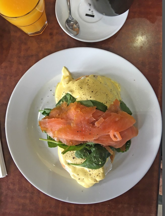
She Who Must Be Obeyed chose Eggs Benedict whilst my selection was simple scrambled eggs with bacon, grilled tomatoes and toast. In addition we added the almost compulsory coffee and orange juice.
PERFECT EGGS BENEDICT COMPLETE WITH GROUND BLACK PEPPER.SCRUMPTIOUS SCRAMBLED EGGS WITH GOODIES.WELL PRESENTED HOT, TASTY COFFEE.
In addition to their great blackboard menu, Roses Cafe is well known for the prepared delicacies which stand refrigerated at the counter where clients place their orders. Close proximity to the displays makes menu decisions somewhat difficult. Here’s why and just a note, these two images don’t show every available goodie or nibble.
PART ONE
PART TWO.
All of these refrigerated morsels are freshly prepared and cooked on a daily basis. I know a couple of locals who are progressively making their way along each shelf from left to right. They reckon its the only way to go.
Today too, by way of a change, I used my iPhone-6s-Plus to make the images. I found it amusing that using the phone to make the photographs created no interest at all from the cafe’s staff or customers. On the other hand, if I presented with my DSLR you’d think I had two heads, the way people stare. Lesson well learned.
After much discussion, John and I came to the conclusion that after one more day at Valley Bore and mucking about, sorry, collecting mineral samples in the Harts Range we would move on to the Henbury Meteorite Site.
As usual, we set off early to Harts Range, armed with information from old Walter Smith and prospector Linz.
As we intended to leave early the next day we said good bye to Walter Smith, his wife Mabel and the rest of his ‘mob ‘ who lived in their Gunyahs not too far from our camp.
I let Walter know that I’d stay in touch with him through Eddy at the Police Station and he seemed please at the thought.
Once on our way, our first port of call was an area named Mud Tank which was known locally as a place to dig for zircons.
The ground at Mud Tank was pockmarked with holes from previous digs and John pointed out that as I was considerably younger than he, it was my job to do the digging, particularly as the long handled shovel was part of my kit. Always generous to a fault, John offered to take the following image.
DIGGING FOR ZIRCON AT MUD TANK.
I must confess that I was digging in a hole mostly dug by some other prospector. After about an hour’s hard labour I gave up digging and helped John sift through the fresh dirt. We found absolutely no zircons or anything else of geological interest and moved on into the range proper.
Back then, easiest access into the range of hills was behind the Harts Range Race Course which is immediately behind the Harts Range Police Station.
HARTS RANGE FROM NEAR THE RACECOURSE
The annual races at the Harts Range Race Course rival many such Territory race meeting and have very high attendance numbers.
Fortunately, or unfortunately depending on your point of view, the course was deserted as we passed by.
HARTS RANGE RACE COURSE.
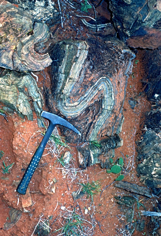
As I’ve mentioned previously, Harts Range was and still is a geologists dream. Mineral formations are everywhere from lengthy exposed quarts veins to garnets, large and small lying everywhere and unusual force formed shapes and sizes of crystals just waiting to be collected.
My strategically placed peological kick highlights one such interestingly shaped short run of quartz and other minerals.
I collected quite a few nice garnet samples, the slides of which are amongst the hundred or so I can no longer find. Unfortunately because over the years I’ve given all my garnet samples away, I can’t photograph them now to show you.
Fortunately this morning , although the slides are missing, I was able to photograph two of my remaining samples from that great day on the range.
The first is a good example of the quartz crystals that are strewn across the range. The second/third is a large lump of either Hematite or Kyanite, I can’t remember which , or perhaps it is neither of the two.
QUARTZ CRYSTALS.
The next two images are of my mineral sample I’m unable to positively identify.
John collected many, many samples but most importantly, he located an enormous feldspar crystal, well over three feet in length that required both of us to lift and, get back to the Landy.
Our work done, we called into the Police Station and bid farewell to Eddy, his family and Eddy’s Aboriginal workmate and tracker.
Farewells completed and much later that day, with assistance from Linz at Bonya, we crated up the sample, said hoo roo to Linz and his wife Joan and returned to Valley Bore to pack up for the last time, ready for an early departure en route to Henbury via Alice Springs.