RELAXING AT AN ULYSSES CLUB ODYSSEY.

Here in the Land Down Under, motorcyclists 40 years of age and preferably older can join a motor cycle club, sorry, a social club for mature motorcyclists. The club is called the Ulysses Club.

Why is it so called? That’s a question to be answered in a later blog.

There are many, many branches of the Ulysses Club across Australia with about 20,000 member motorcyclists, both male and female.

Some years back the Central Administration opened the door for the creation of  overseas branches and now a few have sprung up in Europe, Vietnam and Great Britain.

Membership of the central body gives you automatic membership of all the Branches and that means you can participate in club rides, both long and short, to places of interest almost everywhere in  Australia.

In keeping with the Ulysses theme, some Branches run what is known as an Odyssey, in keeping with the legend of Ulysses himself.

Last month, the Sydney Branch ran an Odyssey to Kempsey, a town in northern New South Wales located on the banks of the beautiful Macleay River and not far rom the coast.

Our motel for the weekend was situate right on the river bank with outside tables and benches from where we could enjoy a few coldies and observe the bird life flying up and down the river. I wonder why it’s called the Moon River Motel?

Just over eighty Ulyssians travelled from all over New South Wales, plus a few from Queensland and Victoria to the Kempsey Odyssey. For the first time in many, many years I observed more participants travelled on four wheels rather than on two, myself included.

The Odyssey organisers provided a range of activities for attendees but on this occasion the decision was taken my our own small group to ‘do our own thing.’

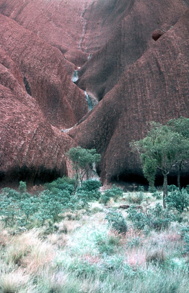
As a result, we ventured to some of the scenic spots not accessible by touring  motorcycles and as a result had the scenic vantage points to ourselves. Here are a few of the images I made along the way.

p1000448

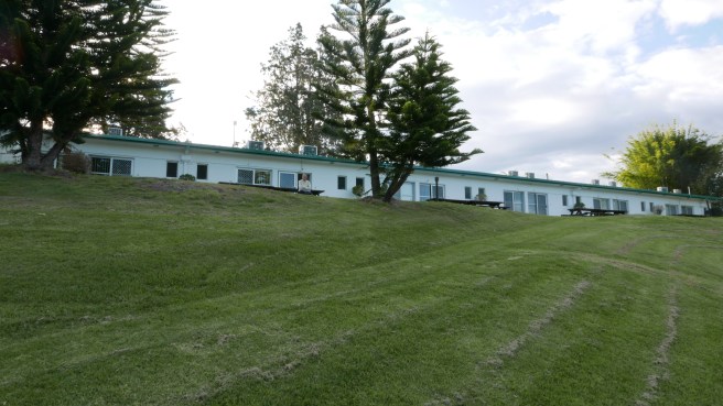
This is the rear of the Moon River Motel in Kempsey on the banks of the mighty Macleay River.

img_0839-copy-blog

Sitting on the bench outside our unit looking downstream on the Macleay we felt at peace with the world.p1000452-copy-blog

Then, as if by magic, the motelier accompanied by his Labrador dog arrived and paused in front of us. He appeared to be concentrating on his iPad but we were in for a real treat.

p1000454-copy-blog

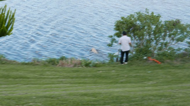
The Labrador picked up a stick and gave it to the Motelier who then threw it out into the river. The dog rushed down what appeared to be a slide near the little white pennant and swam out and collected the stick.

p1000460-copy-blog

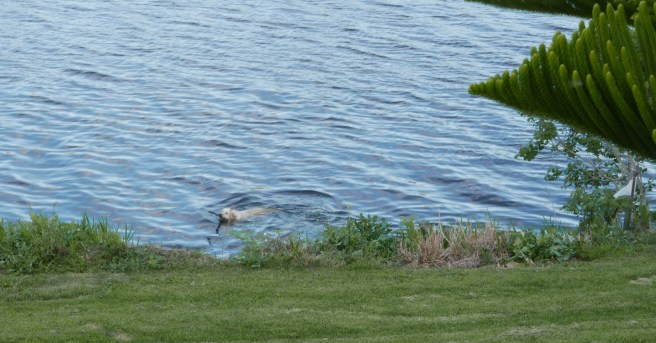
Successfully retrieved, the stick remained in the dog’s jaws until the whole process was repeated, again and again to our great amusement.

p1000442-copy-blog

Later in the morning after a relaxing morning tea in we decided to go view the sights and headed north in our respective all wheel drives.

kempsey-odyssey_24sep2016_0006-copy-blog

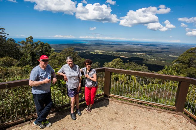
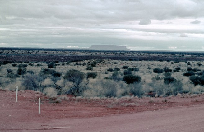
Our first point of call gave us a great view looking south along the South Pacific Ocean coastline towards Kempsey and Forster. kempsey-odyssey_24sep2016_0008-copy-blog

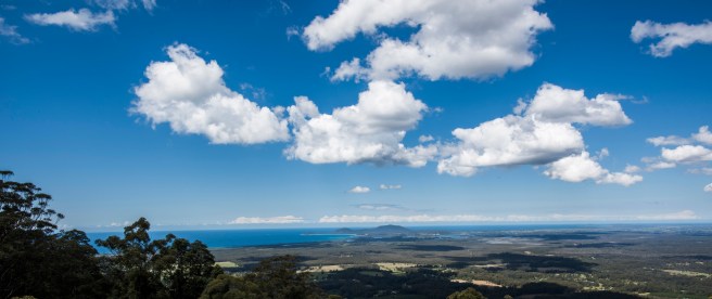
Perhaps the cropped version provides a stronger impression of the pleasing view.

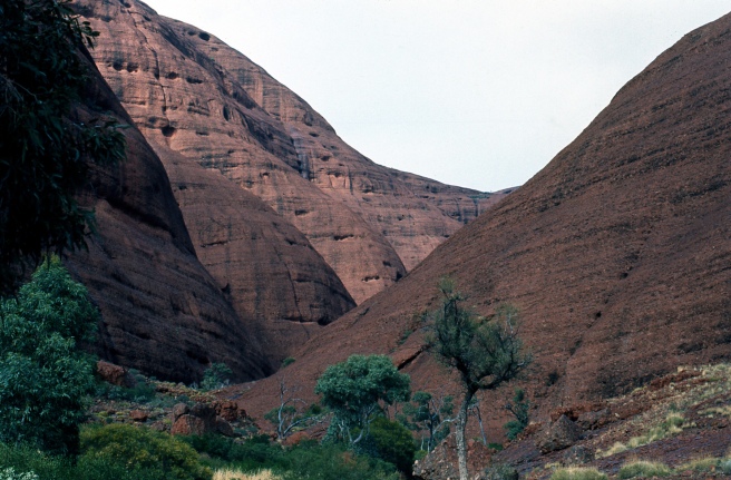
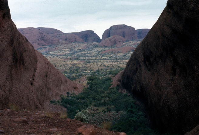
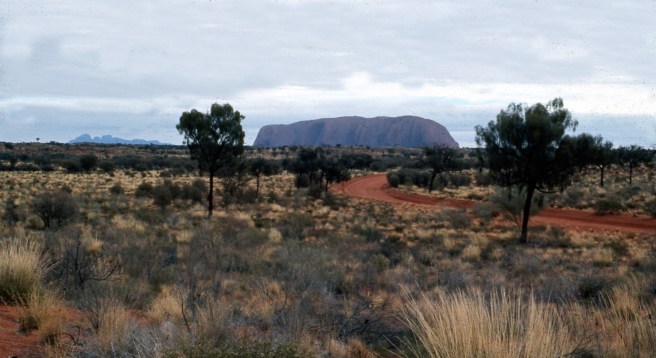
Leaving this spot we travelled further north along the coast and finally made the climb to one of the districts highest points and were provided with another spectacular view.

kempsey-odyssey_24sep2016_0012-copy-blog

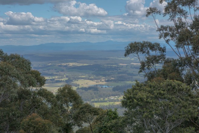
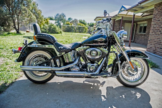
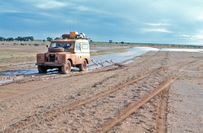
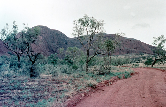
Although the dirt access road was in great condition, large areas of loose gravel had been laid down and it would have been a challenging ride up on any bike, let alone my Harley Davidson cruiser or my mate’s pristine touring Beemer.

Our descent from the summit was easy going in the diesel  Landrover, we just sat in high range second gear and never needed the brakes all the way down to the bitumen. Here we are at the beginning of the way down.kempsey-odyssey_24sep2016_0017-copy-blog

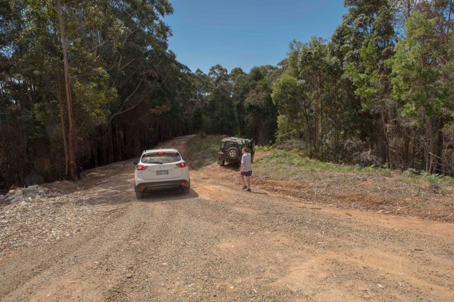
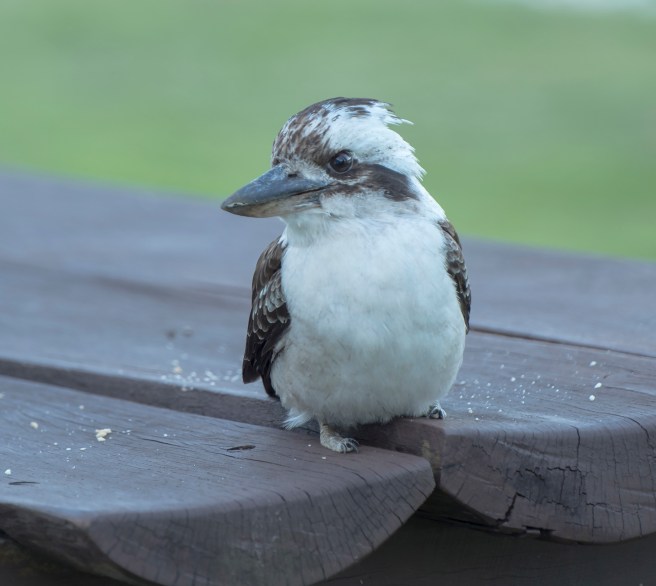
By the time we returned to our motel, it was time for afternoon tea on the river bank and we were joined by a very inquisitive Kookaburra who seemed to delight in being photographed as it sat on an adjacent table and feasted on one of our precious Monte Carlo biscuits.

kempsey-odyssey_24sep2016_0027-copy-4-blog

As dusk arrived, many, many birds commenced their flight home to roost with a large number choosing to travel along the river and we were fortunate to observe quite a number of them in different formations as they made the trip. I particularly liked the ‘V’ formations with their pleasing reflections and this particular group seemed to be just skimming the river’s surface at quite a rate of knots.

kempsey-odyssey_24sep2016_0032-copy-blog

A short time later, we were off to a local club to join up with our fellow Ulyssians for a sumptuous meal, the usual speeches and presentations.

After a few drinks, the usual exaggerated stories of daring do on motorcycles circulated around the assembled mob. It was great listening to yarns that had grown in degree of daring do over the years and it’s a sure thing that some of the riders will become Ulysses Club legends in the not too distant future.  After all, isn’t that how the Ulysses legend began all those centuries ago?

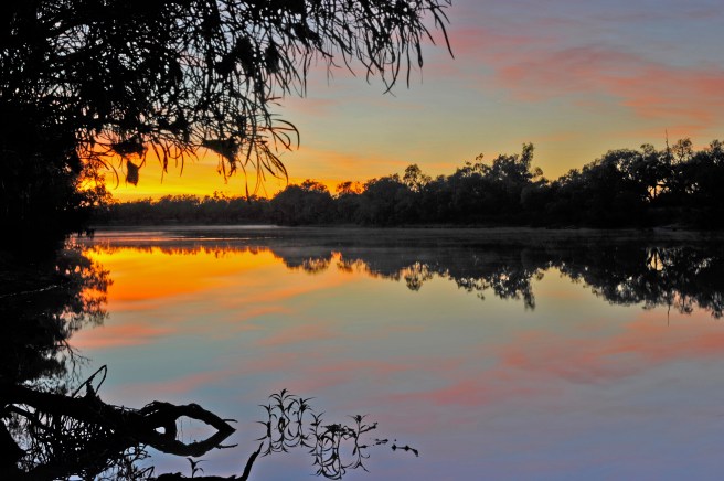
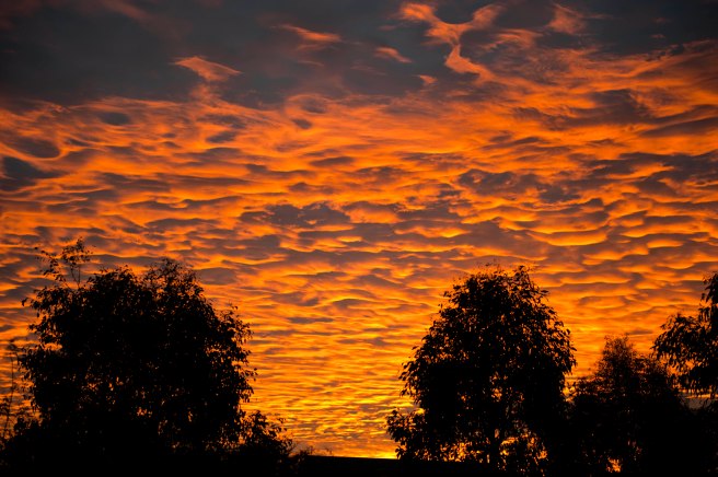
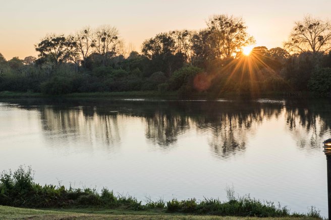
The next day we rose just before dawn to get an early start on our return home journey of about 700 klms.  I popped outside to get one more look at the mighty Macleay just as the sum appeared over the opposite bank. My camera was close by and I grabbed this shot almost instinctively. It hasn’t been photoshopped and I hope you like it just the way it is.

kempsey-odyssey_24sep2016_0005-copy-blog

We all returned home refreshed and looking forward to the next Odyssey with a pledge to each other that next time it will be on two wheels and not four.

Hoo roo for now


MY HARLEY DAVIDSON CONUNDRUM SOLVED.

Following  my cancer diagnosis and surgery in late 2014 I have followed my medicos’ advice and refrained, except for a few  occasions, from riding my beloved  Harley.

Then, back in August this year I received the pleasing information that I’m in remission and can resume riding.

Now my Harley Heritage Softail hits the scales at 327 kilos dry or 720 lbs if that is your preferred measure. Dry means just the bike with no accessories and an empty fuel tank.

Whatever way you care to look at it, that’s  lot of weight so I decided to get something lighter and settled on a Harley Fat Boy, 305 kilos dry or 672 lbs.

Here in Australia as the 2017 model year approaches, special discounted prices are offered on 2016 Harleys and I decided it was time to strike a deal.

The special offers expire today, the 30th September. Have I done a deal?

No.

Why you may well ask?

The answer is simple really.

During my long convalescence I’ve mucked about with the Heritage and changed a few things.

For example, I’ve fitted quick release mechanisms to the leather saddler bags, changed to Fat Boy handlebars, removed the windscreen and added the smallest Harley sissy bar and pillion pad I could find.

You will see the difference in the following two images:

heritage-with-a-bit-more-bling_0603_0002-copy

Here is my beauty as delivered, 327 kilos or 720 lbs dry weight.

heritage-changes_080216_0003-copy-43

Now here is my beauty, minus saddle bags, screen, mini ape bars and the extra large pillion pad.

Total weight of the goodies I removed, 48 lbs or 22kilos.

If you do the math and come up with the same figures as I did,  guess what?

My stripped down Heritage now weights exactly the same, dry, as does the Fat Boy I was contemplating buying,  305 kilos or 674 lbs.

As both bikes have the same capacity fuel tank, they would be equal in weight when fully fuelled up and ready for the road.

Now on the plus side, everyone tells me I look ‘fantastic’ when I’m out on my Heritage and should never change the model.

Just have a gander at yours truly out on the Heritage. It’s said there is nothing like a bit of self promotion, so, here I am.

scan10126-copy

scan10125

Looking every inch a ‘biker’ and loving it.

Mail0002 copy

Here I am again, this time pretending to be an intellectual after graduating with a Bachelor of Arts from Monash University. What a poser.


Anyway, as soon as it stops raining and the roads dry out, I’ll be going for a ride on my Heritage, all thoughts of a Fat Boy out of my mind and I’ll congratulate myself that the bike’s weight loss has saved me quite a few dollars that I can now invest in more bling for my beloved Heritage.

Hoo roo for now.


LIFE AND DEATH OF A WONDERFUL WATTLE TREE.

The Australian Cootamundra Wattle tree ( Genus Acacia, family Leguminosae) is fast growing shrub or tree renown for its brilliant yellow blossoms.  Wattle trees thrive in warm climates and seem to be impervious to the ravages of drought or flooding we experience here inThe Land Down Under.

Although very fast growing, wattles are not long lasting trees with an average lifespan of about seven years.  In some areas of Australia, wattles, particularly the Cootamundara  variety, are declared to be a noxious weed, partly due to their great ability to self seed and pop up everywhere.

Seventeen  years ago when we purchased our residential block of land it was totally devoid of of trees and we decided to plant as many native trees as was practical.

So, we bought quite a number of small gum trees and various wattles in what we call tube stock size. That means they were only about 6 inches or 150 cm tall.

Being fast growers, the wattles were planted near the gums to provide wind protection and they have done their job admirably.

Unfortunately our wattles are now well past their normal life span and the strong winds this last winter have created many branches to fail.  Until now that hasn’t been a problem as I’ve been able to lop the offending branches and run them through our mulcher.

However, our largest wattle decided last week to divide itself into a number of parts,  demolish part of our boundary fence and obstructing the nature strip beside the adjacent main road.

This is how it looked from the main road a few days after it snapped apart. wattle-in-ruins_09sep2016_0002-copy-3


wattle-in-ruins_09sep2016_0001-copy-3

Now as any man reading this will acknowledge, armed with either a bow saw or a small chain saw, an hour or so would see the total demise of the offending wattle tree, have it loaded onto the trailer and dumped at the rubbish tip in good time to go to the pub with the mates.

Well, armed with the bow saw I attacked the offending limbs with great vigour. After an hour or so I came to the conclusion that I was kidding myself. A quick phone call to an accredited tree removal firm saved the day.

Bright and early the following day Aaron and his offsider Marty arrived in their truck which was towing a large mulcher, which by the way, was at least 100 times bigger and more powerful than mine.

They launched their attack within minutes and I was amazed by their teamwork and speed of action.

Sawdust flew, the mulcher roared and the wattle tree swiftly disappeared into the mulchers gaping maw.

Here are a few images of the team in action:wattle-removal_09sep2016_0007-copy-3wattle-removal_09sep2016_0017-copy-3

wattle-removal_09sep2016_0029-copy-3

wattle-removal_09sep2016_0071-copy-3

wattle-removal_09sep2016_0088-copy-3

wattle-removal_09sep2016_0136-copy

wattle-removal_09sep2016_0158-copy-3

This two man team accomplished in short time a task that would have taken me a week at least of hard hacker. They not only worked quickly but safely.

All that was left was a small portion of the wattle’s  trunk upon which I intend to place a little plaque.

The mulched tree will not go to waste as it is destined to be recycled into compost.

Today we purchased more saplings and shrubs to replace our wattle and the planting will start next week.

Hoo roo for now.


FACEBOOK PHOTO CHALLENGES.

Today marks the completion of a seven day Facebook Photo Challenge I accepted after nomination by a ‘mate.’

One of the terms of acceptance was to nominate two others to take up the ‘challenge.’

One of the individuals who accepted my nomination indicated that he had no intention of nominating anyone else to enter and gave the reasons for his decision.

During the past seven days I’ve thought a lot about these so called Facebook photography challenges.

When I first opened a Facebook account I readily accepted these challenge nominations and found them to be fun.

After a while though the ‘fun’ factor reduced to almost zero and I accepted nominations purely on the basis of not wanting to disappoint the nominators.

Then, as happened to my nominee mentioned above, my nominations seemed to get lost somewhere in the blogasphere.

Now, on reflection, I’ve come to the conclusion that what once was fun has  become an unwelcome time waster.

Accordingly, from this day on, this little black duck will gracefully decline to accept any Facebook photo challenge nominations.

It’s hypocritical of course but what pops up here in blog world is vastly different and I view what happens in this space with a totally different mind set.

Hoo roo for now.


FALLING FOR THE PHOTO A DAY COMPETITION TRAP.

Wouldn’t you think that I have been around long enough to resist nomination for Facebook competitions. Once bitten twice shy as the saying goes.

I thought so too but in a moment of weakness I accepted a mate’s nomination and signed on for an image a day for seven days.  As you are probably aware, acceptance includes  an expectation that others will be nominated too. Accordingly I nominated two others to take up the challenge, both of whom accepted.

This time around I’ve opted to cheat, just a little bit. After all an image is an image no matter it’s age and provided it fits the required genre.

I searched my records and came up with four suitable archived images and since my nomination have photographed the other three.

Last Tuesday was Day 1 and I uploaded an image I’d taken at dawn that morning from our front verandah. Here it is:DAY 1

On Wednesday morning I cheated and uploaded this image from my archives:

DAY 2

Then this morning I was at it again with one from the archives, showing a section of Mt Riddock  Cattle Station in what is known as the bottom end of the Northern Territory. It’s from a scan of a Kodak ISO 25 slide:

DAY 3

I’m undecided with the order in which I’ll post the remaining four images, two of which are archival and two taken since last Tuesday. The first of the four is of a sunset I shot just after 5pm on the 20th May, 2011 from our back door.

For the technical minded I used my Nikon D700 with my Nikkor 70-200 mm f2.8 lens set at 70mm, 1/125th second at f2.8, ISO 200:

DAY 4

This next image is also archival from last summer. I used my D700 and Nikkor 105mm  f2.8 Macro lens set at 1/80th second, f9, ISO 200 with the Nikon Speedlight SB 800 to bring our more detail:

DAY 5

The last two images  were made yesterday during a break in the lousy light conditions  when the two Galahs and the Nankeen Kestrel made their entrance into our backyard, not at the same time of course.

Both images were made using my D810 with the Nikkor 300mm lens , aperture priority f4, 1.1250th second at ISO 100.

DAY 6

DAY 7

Will I take up another nomination in some future competition? Taking a leaf out of every politicians note book, I’ll never say never, just in case.


Hoo roo for now.

CENTRAL AUSTRALIA TRAVEL BACK IN THE DREAMTIME – AN EPILOGUE.

During the adventure I’ve detailed in the previous nine posts, I didn’t worry too much about keeping copious notes. However, I did tick off the days as they passed by.

As it transpired, purely by luck and not good management, the 19th July, 1973 became the most significant day during the whole of the journey.

That was the day I photographed Ayres Rock, Uluru to give it the correct title, with water cascading down its sides. Yes indeed, it was raining on The Rock.

Now many people, myself included, were of the belief that The Rock was discovered in 1872 by Ernest Giles. It’s true that Giles was the first  white man to see the monolith from a distance and he returned to claim it in 1873.

However, he was beaten to it by William Goss who, on the 19th July, 1873 at The Rock, claimed and named it Ayres Rock after the Chief Secretary of South Australia, Sir Henry Ayres.

According to many references, it was raining on The Rock on the 19th July, 1873, exactly 100 years to the day that John G and I witnessed the same scene as had William Goss.

Here is that great image, once again.

ULURU 5 copy 3
RAINING ON ULURU, 19th JULY 1973.

I’ve also mentioned Walter Smith on many occasions and I kept in touch with him for 17 years until his death in June 1990, just days before his 97th birthday.

My thoughts of Walter were revived recently at the funeral of another mate whose legendary exploits were canvassed by various speakers at the funeral.

Later at the wake it was pointed out that legends only live when they are repeated and that was certainly the case with Walter. Once you got to know him he reinforced his legend that he was part Afghan and part Aranda.

On a number of occasions he told me that his tribal name was Wati Yuritja which meant Man of the Water Dreaming. He reiterated on a number of occasions his association with the explorer Madigan and the discovery of the monster meteorite samples and detailed his exploits as a cameleer.

I admired Walter and his bush craft and I regularly repeated his legend to anyone who would listen.

In 1998 on visit to Uluru-Kata Tjuta I found a biography of Walter Smith and bought it on the spot, mainly out of curiosity.SIMPSON 73?181 copy 3

The book has sat comfortably on a bookshelf here in my office, almost forgotten until this morning and flicking through it I’ve discovered a number of details concerning Walter’s legend, all of which are referenced and accurate..

Firstly, Walter Smith was neither part Afghan nor Aboriginal by birth. Walter was born on the 2nd July, 1893 at Arltunga not far from Harts Range in the Northern Territory.

His father, William Smith, a Welsh miner and his wife Topsy had, over the next twenty one years, ten more children after the birth Walter.

According to the biography, all of Walter’s camel exploits are true and he was certainly a renown bushman during his life.

The most extraordinary fact I’ve now discovered that it was not Madigan with whom Walter associated but the famous ill fated explorer L.H. Lasseter of  lost gold mine fame.

Walter provided the camels and accompanied Lasseter for much of his journey  to find the lost mine, a journey that cost Lasseter his life.

Also, it was Walter who discovered the massive meteorite at Henbury and dispatched it to a South Australian museum for assessment.

Digging out Kimber’s book has reignited my interest in Walter Smith and he is now my subject of much future research.

Finally, I thought I’d make some concluding comments about the so called Simpson Desert expedition.

My long departed mother was my active social secretary and whenever she came across something even remotely associated with my activities it was collected and stored it away. Here is a classic example of Mum’s collecting.

SIMPSON 73?182 copy 3
A NEWSPAPER CUTTING

Some months after the main mob returned to Sydney, the Australian Museum in Sydney hosted a get together for all the participants. The few of us who attended were given the opportunity to see many of the bird samples collected by the ornithologists, together with a range of amphibians, a reptile or two but absolutely zero from the world of geology.

If my memory serves me correctly, I was the only representative of the small Land Rover Club group and geologist John G was also absent.

Those of us who volunteered with our four wheel drives were assured our costs would be met. Only forty three years have passed and I’m still checking the mail.

I visited the NSW Institute of Technology, Geology Department to see John G some time after my return. I saw the mounted feldspar crystal taj=king pride of place in the foyer of the department. No sign of John G so I left a message for him to telephone me. As the crow flies, my office was not far from his. A phone call never came and I never laid eyes on him again.

Linz the prospector, Dr Dave  and I remain in regular contact. Over the next few years I was such a regular visitor to the Harts Range Police Station and a regular driver of the Station’s vehicle that Eddy insisted I apply for a Northern Territory Drivers Licence. I did so and held it for about ten years before surrendering it.

Eddy eventually transferred to Darwin, suffered terrible losses in Cyclone Tracy and we accommodated him at home in Sydney when he was given leave to come south and recuperate. On his return to Darwin I visited him on a number of occasions but he retired and I’ve have lost all contact with him.

Well there we are. As is the rule, what goes on tour stays on tour, so that’s it folks.

Hoo roo.


CENTRAL AUSTRALIA TRAVEL BACK IN THE DREAMTIME -PART 9

The home fires were burning brightly when we started the run to Adelaide to suit John’s arrangements. Unfortunately the sky was not as bright and rain was still obviously to be expected.

We turned right from the Lasseter Highway onto the Stuart Highway south of Alice Springs and as we neared Marla John suggested we detour via Oodnadatta and through to Leigh Creek where he hoped to collect some Tektite.

He explained that Tektite, a pure glass, could be coloured black, brown or green. It was a terrestrial debris he explained, ejected during extraterrestrial  meteorite impacts.

I was intrigued and John added that the area around Leigh Creek had the largest Tektite fields in Australia. I wasn’t sure if John’s suggestion was designed to placate me but if it was, he certainly succeeded. I was now hooked on Tektite.

The moment we turned off at Marla the driving fun began and the 211 klms to Oodnadatta was a great  mud run.

SIMPSON 73?173 copy 3
A TYPICAL PART OF THE MUD RUN BETWEEN MARLA AND OODNADATTA.

When we finally reached Oodnadatta, the sign at the town’s entry told it all and what we could expect next.

OODNADTTA 1 copy 3
MY MUDDY LANDY AT THE ENTRY TO OODNADATTA.

We stopped for coffee and snacks in town and having a yarn with curious locals revealed the fun we were going to have on the next section through to Maree.

The going was quite slow and we decided to make an early camp if we could find a dry spot.

Luckily enough we came upon a nice spot complete with a tree and some great examples of Sturt’s Desert Pea which thrives in arid conditions.

SIMPSON 73?102 copy 3
OUR DRY OVERNIGHT CAMP SITE COMPLETE WITH BLUE SKIES.

Sturt’s Desert Pea is a beautiful desert plant with its vibrant colour and interesting foliage.

SIMPSON 73?169 copy 3
STURT’S DESERT PEA.
SIMPSON 73?176 copy 3
A CLOSE UP. GREAT FORM AND COLOUR.

Next morning we made another early start. I can’t speak for my passenger John, but as the driver it was a heap of fun. If I recall correctly, the next day the road from Oodnadatta to Maree was closed to all traffic and this sign was an indication of why that took place.

SIMPSON 73?171 copy. 3
THE SIGNS TELL IT ALL.

The track we were on runs parallel with the old Ghan Railway line which in those days terminated at Alice Springs. The Ghan was named after the Afghan camel drivers who back in the 1890’s and early 1900’s were the major source of goods transport between Port Augusta in South Australia and the Northern Territory.

Trains running along the line where often held up by sand drifts and floods and could be sometimes be delayed for days as the train crew shovelled the stand off the lines or waited for flood waters to recede.

As we travelled further south we made quite a few little creek crossings and all seemed Ok until we reached the Algiebuckiner River which was in flood. There was Nissan Patrol 4 x 4 stopped on our side of the river and a what looked like a Toyota Landcruiser stopped on the other side.

I knew that knee high water that wasn’t flowing too swiftly was fordable in my little Landy, provided that the crossing’s bed wasn’t too soft.

I waded across to the other side and the water only reached my knees. Fortunately the river bed seemed more gravelly than mud or sand and the river flow was almost at a standstill. After checking from side to side of the path I’d checked I decided that a crossing would be manageable and waded back to John and the Landy.

The photo opportunity was too good to miss so I armed John with my camera and he waded across to a view point I had indicated to him and adopted his temporary role as trip photographer.

All of this mucking about had a positive side to it as the Landy’s engine, gear box and differentials had cooled down somewhat, therefore reducing the risk of their breathers sucking water in the event of a disaster during the crossing.

All that was left for me to do was to fit my small tarpaulin radiator cover and drive across to the other side, sticking to the path I’d chosen.

I decided on low range third gear to maintain a reasonable speed to produce a great bow wave and felt confident that all would be well. On many trips with the Land Rover Club, river crossings were encountered and I’d had quite a bit of experience in water crossings.  I remembered to maintain a steady accelerator pressure and keep my left foot away from the clutch pedal.

Engine switched on, third gear engaged and off we went, riding well behind a great bow wave.

We reached the other side without a problem, not a drop of water entered the cabin and the little engine didn’t miss a beat. Modern 4 x 4 owners please note, not a snorkel tube in sight.

When the slides were finally processed, John’s photographic skills were evident as the following images show.

algiebuckiner river6 copy 3
QUITE A WIDE EXPANSE TO BE FORDED.

ALGEBUCKINA RIVER 18 copy 3

THE WADING COMMENCES.

Algiebuckiner river2   copy 3
NO PEDESTRIAN CROSSING HERE – GET OUT OF THE WAY DUMMIES.
Albiebuckiner river 3 copy 3
NEARLY THERE, NOT A PROBLEM. NOTHING LIKE A LANDCOVER.

In this last image, you can see the old railway bridge over the river and the length of the bridge is a clear indication of how wide the river can become when in full flood.

Finally we reached Maree, fuelled up again and shortly afterwards arrived in Leigh Creek where we camped overnight, ready for an early start searching for Tektites.

Our search was fruitful too with John collecting many, many samples and I limited myself to about half a dozen or so.

I’ve searched high and low for my Tektite samples but they have simply disappeared during the ensuing years and my multiple address changes.

We continued on and stopped overnight just outside Quorn ready for the run into Adelaide the next day.

John and I said our farewells in Adelaide, South Australia and I started off towards home in Cronulla, New South Wales.

Strangely my thoughts on the way home were more about my return to work and what had happened there during my long absence.

I was soon to find out.

Thanks for reading, it’s been a lot of fun putting this series together and the process has brought back many,many great memories.

Hoo roo till next time.


CENTRAL AUSTRALIA TRAVEL BACK IN THE DREAMTIME – PART 8

John and I got an early start en route to The Olgas or Kata Tjuta as we should call them.  Even though the sky was overcast again it didn’t dampen out enthusiasm for what lay ahead.

From quite a distance over the last few days we had glimpsed the Olgas on a number of occasions. Here is one such  glimpse taken from foot The Rock itself.

OLGAS 10  copy 3
A DISTANT KATA TJUKA

However,  getting closer revealed how mysterious and dominating they really are.

OLGAS 6 copy 3
ON THE APPROACH TO KUTA TJUKA FROM ULURU.
Olgas 4 copy 3
GETTING CLOSER.
OLGAS 9 APPROACH copy 3
JUST AROUND THE NEXT BEND -PERHAPS.

Then suddenly Mt Olga loomed large and dominating the landscape.

OLGAS 12 copy 3
Mt OLGA

As you get closer, the impact of The Olgas increases and I couldn’t  help but wonder about the Initiation Ceremonies that traditionally took place there. In fact, on a subsequent visit a year or so later I learned that Secret Men’s Business, at significant times, still takes place there.

OLGAS 8 MT OLGA copy 3
CLOSER STILL TO Mt OLGA.

John G continued to demonstrate his navigational skills and not long after this shot was taken, guess what.

OLGAS 5 copy 3
WRONG WAY CHARLIE BROWN

To be fair, back then there was no such thing as civilian GPS. Map and compass was the way it was done. Our topographical map was getting a bit battered and we had been lucky that on only a few occasions a U turn was required. This was one such time. Strangely, John appeared reluctant to use my souvenired  military  issue magnetic compass.

OLGAS 11 copy 3
‘NEVER REALLY LOST’ TO QUOTE FROM PADDY PALLING FAMOUS BUSHWALKING BOOK.

Eventually we reached the spot we were looking for in order that we could walk into The Valley of the Winds.  In 1973 it was quite a different  climb to the way it is today. The track was feint and mostly very hard to find and the going was very rough and in spots particularly steep. Finally we reached the spot near where the Valley began.

OLGAS 3 copy 3
NEAR THE ENTRANCE TO THE APTLY NAMED VALLEY OF THE WINDS.

The view into the Valley proper was breathtaking and my image just doesn’t do it justice.

Olgas 2 copy 3
THE VALLEY OF THE WINDS.

On a number of subsequent trips I’ve been fortunate to descend to the valley floor and explore its fascinating features. It’s an immense area and never fails to amaze everyone who visits there.

Unfortunately, both John and I were now both facing time restraints and decided to begin our journey home.

We journeyed back to The Rock, replenished our depleted water supply and started back to civilisation.

Here is our last sighting of Ayres Rock.

UJLURU 34 copy 3

On reflection, John and I had been in close company for many weeks. Mostly with no other company close by. For two men who had just met we got on particularly well but I suspected as we left Ayres Rock that we were not really overjoyed with each others company any more.

Nothing had been said, there was no apparent tension and we were as courteous to each other as we had been since Day 1. However, to quote from the movie’ The Castle,’ ‘It’s The Vibes.’

That night as we sat around the camp fire our discussions turned to the return journey.

I’d planned to get home via Mt Isa and the route taken by the little group from the Land Rover Club. I indicated to John that would be quickest.

It was then that John informed me that it had been his intention all along to return to Sydney by air from Adelaide and he expected me to deliver him to the South Australian Capital. I gathered that he had an open ticket for that journey.

I must have been a softie way back then because I couldn’t bring myself to tell him what I thought. Instead I pointed out that the way south to Adelaide was mainly on dirt roads with some river crossings and that the rain we had experienced might provide some obstacles.

I gave a drop off for him in Alice Springs as an alternative but from his response I got the distinct impression that dollars and cents were an issue. I didn’t pursue it. After all, I hadn’t chased recompense for the gallons and gallons of petrol I’d brought.  Anyway, what’s a bit of mud and  water across the track for a short wheel base Landrover.

Therefore, get prepared for Part 9.

Hoo roo for now.


CENTRAL AUSTRALIA TRAVEL BACK IN THE DREAMTIME- PART 7.

Two  things must be said about camping in Australia’s outback and in my view are perhaps the most significant elements of the experience.

The first is the sky. Day and night you have a three hundred and sixty degree unimpeded view. It’s like living inside a gigantic inverted pudding bowl. There are just not enough adjectives to fully describe the feeling the sky and its stars create.

The second is the absolute silence. Except for the occasional breeze through the trees, the rustle of the grass and the sounds of native animals going about their night time routines.  Many describe it as ‘The Sound of Silence.’ Hows right they are.

John and I awoke to a clear day, with not a drop of rain and great light for photography and so we decided to circumnavigate The Rock on foot for the second time.

Way back then there were no access impediments and everything was accessible.

Uluru, to give it its Aboriginal name is revered by Aboriginal people and is a genuine Special Place or Sacred Site as many now call such places.

To climb to the The Rock’s summit or anywhere on it, as many tourists are wont to do is considered sacrilege by Aboriginal people and now even the National Parks people advise against the climb but it is still not prohibited.

John was determined to do the climb and even although I politely requested that he observe  Sacred Site status he did set off determined to make it to the summit.

I suggested to John that he take my camera with him and grab some images and he agreed.

ULURU 8 copy 3
JOHN G CONTEMPLATING THE CLIMB AHEAD.

As I watched from the base, John got as far as the first pale spot just below the two individuals you can see and stopped.  After a short break he turned around and descended. He never indicated why he had a change of heart. Giving me back the camera he said he had taken just one shot.  Here it is.

ULURU 7 copy 3
A VIEW FROM ULURU TAKEN BY JOHN G.

After a brief interlude, we set off around The Rock for a second time, a distance of 9.4 klms or 5.8 miles.  The Rock itself is sandstone, 348 metres or 1,142 feet high. It’s 863 metres or 2,831 feet above sea level.

The Anangu people who are the traditional owners of Uluru have a name for every individual element of Uluru’s rock faces. Way back then I’d learned many of the namers and committed them to memory but now, all of those years later I can recall only a few and that’s why I’ve refrained from giving a specific name to any of the following images made on our seemingly endless walk.  I made many more images during this walk but they are now missing from my archive.

ULURU 9jpg copy 3
THIS ONE IS OBVIOUS THOUGH, ‘KANGAROO TAIL’.


ULURU 4 copy 3

ULURU 25 copy 3

ULURU 28 copy 3

ULURU 3 copy 3

Ancient and more recent rock art by the Anangu people is in abundance at Uluru and I was fortunate to photograph some of them. I’d neglected to bring a flash unit for my camera and in many of the painting locations the light and the slowness of my slide film, 25 ASA prevented me from taking any useable photographs.

ULURU 13 copy 3

ULURU 29 copy 3

ULURU 27ABORIGINAL ART WHITE MAN AND HORSE. copy 3

ULURU 10 copy 3

On this walk I found this  blaze on one of the small trees. My inquiries with some of the locals who spoke English provided no information as to the source or meaning of the blaze. Subsequent inquiries have also drawn a blank  and I’ve never stopped wondering about its origins.

ULURU 17 copy 3

Our walk complete, we wandered back to the Landy and hunted up  camp site for the night. Finally we decided on a spot in the main observation area where one camp had already been set up.

ULURU 30 copy 3
THE MAIN VIEWING AREA IN 1973. ALMOST PACKED OUT.

We selected a site far from the maddening crowd and close to the enormous amenities block you can see in the following image..

ULURU 36 cop 3y
ABOUT AN HOUR OR SO AFTER THE PREVIOUS IMAGE. NOTE THE AMENITIES BLOCK IN THE RIGHT MIDDLE DISTANCE.

This is the view of Uluru that is most popular with tourists. As the evening sun drops lower in the sky, the colours of The Rock change dramatically. These days the observation area is much further back and well regulated. Of course the tiny amenities block is long gone and modern facilities are available close by as part of a large tourist facility.

Our forward planning included The Olgas, or Kata Tjuta to give it its correct Anangu name. The area is now officially the Uluru-Kata Tjuka National Park and is administered well by the traditional owners.

Accordingly, we prepared for the morrow’s early start and we will come to that in Part 8 so hoo roo till then.


CENTRAL AUSTRALIAN TRAVEL BACK IN THE DREAMTIME – PART 6

In drizzling rain we left Henbury en route to Ayres Rock and The Olgas. I know I should call the The Rock correctly as  Uluru but old habits die hard.  After all, I first visited Ayres Rock in 1962 in my little Simca Aronde.  I’ve no trace of the photos I took way back then but I remember that it was even less developed way back then.

We were disappointed that our Henbury meteorite hunt had been aborted but on the positive side we got out of Crater 6 without too much trouble and with no losses.

The closer we got to The Rock the more it rained and the soggier became the track. Fortunately I’d put new off road tyres on the Landy before leaving home and they were handling the wet conditions without fuss.

It’s the fortunate few who are able to see the impact of rain on the arid parts of the Territory and on this part of our adventure we were indeed fortunate as we passed this expanse of water on our way out from Henbury.

SIMPSON 73?168 copy 3

Not long after, in the distance we caught our first view of Mt Conner. This massive mesa is often mistaken by first time visitors as The Rock itself . There are a number of tracks that take you across to Mt Conner but as our time was running short we had to resist the urge to explore the mesa up close.

Mt CONNOR  copy 3
A DISTANT MtCONNOR FROM A DRY BIT OF ROAD.

Similarly to The Rock the changing light causes colours of Mt Conner to alter.  Here is another view as we got closer and the light was changing.MT CONNOR copy 3

Where we stopped to make this last image of Mt Conner I noticed a Bull Ant’s nest with it’s built up water proofing mound. The old bushies and the Aboriginal people can tell when big rain is coming when they see the Bull Ants creating their little walls. I put the match box along side the nest to give an indication height.

SIMPSON 73?172
A FLOOD PROOFED BULL ANTS’ NEST

Finally Ayres Rock with a distant view of the Olgas came into view.  For once I made a note of the odometer reading and when I checked when were actually there, it was just over 9 miles from The Rock when I made the photo.

Back then the road into The Rock was just dirt and fitted into the landscape with no significant impact. It was well compacted dirt too and a pleasure to drive on, just as it was when I visited in 1962 in my little Simca.

ULURU 35 copy 3
NINE MILES OUT FROM THE ROCK.

A few isolated puddles on the road were an indication of the amount of rain that preceded our arrival.

uluru 21 copy 3
A FEW PUDDLES ALONG THE ROAD.

Getting closer, the enormous size of this spectacular monolith becomes more apparent.

ULURU 2 9miles OUT copy3
COLOUR CHANGES ARE ALMOST CONSTANT.

Finally we reached a vast cleared area near The Rock which now was covered by either low cloud or mist. It was an amazing sight.

ULURU 15  copy 3
AYRES ROCK SHROUDED IN MIST.

Closer still the light had changed again and the mist was beginning to lift revealing some of The Rocks features.

ULURU 16jpg copy 3
LIGHT CHANGES AND LIFTING MIST.
ULURU 19 copy 3
NOTE THE VISITORS’ FACILITIES INCLUDING THE OPEN FIRE PIT.

After boiling the billy we decided to take a drive around The Rock and look for a spot to set up camp. Were we in for some surprises as we came upon streams of water gushing down the sides of The Rock.


ULURU 5 copy 3
RAINING ON THE ROCK. WHAT A RARE SIGHT. 
ULURU 14 copy 3
ANOTHER RARITY
ULURU 11 copy 3
JUST A LITTLE BIT CLOSER.

After circling the monolith we returned to the main observation car park and joined a crowd of five other vehicles with no people to be seen anywhere.

ULURU 22 copy 3
THE MAIN TOURIST OBSERVATION PLACE.

Later in the afternoon we moved around to a deserted spot and set up our camp early in order that we were organised to walk right around the Rock the next day.

Seeing the water cascading down the rock faces was an inspirational experience and I recognised the place as a genuine Sacred Site. I could feel the power and sense the mystery that was present.

In a strange way I was pleased that John never mentioned if he felt any personal impact from what we were observing.

Another plus was the total absence of any elements of bureaucracy, no commercial activity of note and all the visitors we encountered during our stay were responsible adults.  How different it is there today.

Hoo roo for now.